
Introduction
You might have a geology model, but is it delivering million dollar value? What should make investors more uncomfortable is very few explorers actually have a model of what they are trying to delineate, and even less actually use it to target. Start with a simple question the next time you look at a model: “Where is the part with the gold in it?” (or, of course, whatever element you are interested in). If there isn’t a simple answer, one thing to click on, it needs work. I’ll show you why in this article.
Last time, I introduced my definition of a targeting model and demonstrated how effective they can be at reducing costs (spoiler: very effective). I want to take a step back in this article to talk about one of the main ingredients in a targeting model: the geological model.
What is a geological model?
By geological model, I mean a set of volumes that together fill the volume of interest and that correspond to the main geological features required for the project. Every point in the volume of interest a geological label. If it doesn’t do that, it’s not a model, for my purposes.
That means just some drillholes in 3D is not a model, and just a set of surfaces isn’t one either. We have to be able to label data with what geology is it. I want to say now that by this definition, maps are very much models too, as long as they are a real, interpreted geological map. They just work the problem in 2D instead. Sometimes that’s the best way to go, particularly in the beginning of a project or when a project extends over a very large area of interest. So every time I say 3D, just know it applies to 2D too.
The main features required for every project are different. More is NOT better, in general. Every feature in a model becomes something that must be maintained and turned on and off and considered. Models are (or should be) used many more times than they are built. That means we should endeavour to make them as simple and as powerful as possible while we are making them – a principle called “parsimony”.
What do I mean by “powerful”? I mean that the model is useful for the project’s purpose. And what is the project’s purpose? To identify and map a distribution of metal in 3D.
Another thing about geological models is that they are rooted in a realistic set of geological processes. That means that part of the power of a model is that we can use things we know about geology in general to help build confidence in the model and guide us in its construction.
That means keeping in mind the broad strokes of the tectonic history of the volume of interest and linking features in the model, and implied events, with things that have been described and identified based on other datasets. Of course, mineral deposits are almost by definition places where rocks don’t behave quite how they should, but that is why broad strokes are more important than the nitty gritty.
How does it contribute to targeting?
The main purpose of the geological model as part of a targeting model is to account for the variability of the deposit that is easily explained. That variability is different for every project and can vary somewhat according to the maturity of a project. But all deposits have some variability that we can easily explain. For example:
- Orogenic gold: mineralization is hosted in shear zones and veins, tabular zones that are pretty continuous along strike and down dip
- Porphyry: mineralization occurs in association with intrusive bodies
- Volcanogenic massive sulfides: mineralization occurs at or near an important horizon representing the paleo-seafloor
- Deposits under cover: mineralization occurs within the basement below otherwise uninteresting basin/cover rocks
We do not need to rediscover this portion of the model. We know it already. Doing work with the data to identify something that should already be in the drilling logs is not a good use of energy.
This explainable variance will also tend to be the first easy win from some kind of machine learning algorithm, which is essentially clustering data in multidimensional space to rediscover it. The problem is that it can distort our evaluation of the algorithm. It can make the algorithm seem more effective than it really is, because it is just solving the easy part of the targeting problem. On the other hand, it can make algorithm seems much less powerful than it really is. That’s because the weaker, highly valuable “within-structure” signal you are after is drowned out by the much stronger, less valuable “structure-background” signal.
Target within the feature you know about, not to find the feature.

Why we need it
We need the geology model because we need to look specifically at a certain feature when we consider drilling targets. We should not have to ask ourselves “will this target hit the structure”. It has to. We ask ourselves, “is this the best place to drill within the structure, given what we know about it so far?”.
The early win here is that a simple model of “the thing that really matters” for a deposit is in itself a tremendously useful thing. As I said in the beginning, this seemingly simple thing is in fact quite rare. There are all sorts of reasons why, which I will discuss more in some later articles about what stops us and what the idea of complexity is often hiding.
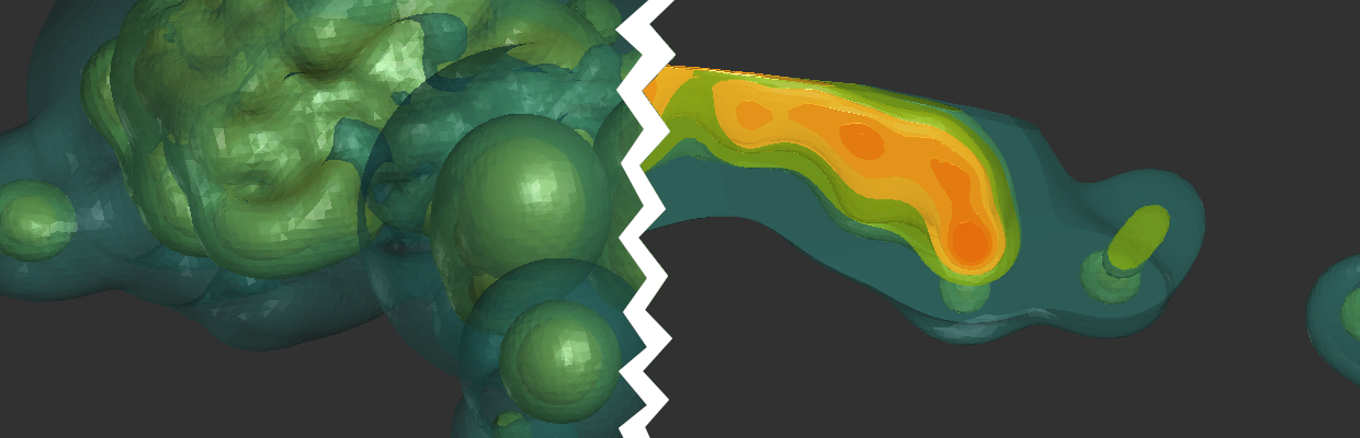
In the example from my demonstration last time, I made enough of a geology model to capture the main structure, which was narrow and tabular like a vein. From then on, I exclusively worked within this structure. I don’t want to interpolate geochemistry everywhere. I only care about what happens within the structure. We need it to narrow down the problem, to act as a filter to increase the signal to noise ratio, and to simplify things.
The reality is that the ability for the data to indicate good and bad parts of a structure is already not very strong. We need to ensure that we can capture any signal that is there. The idea of explaining away the variance you know about so you can focus on the more interesting, more difficult to see and understand variance, is an incredibly important one. It’s the same reason resource estimates separate high- and low-grade zones before estimating anything. Once you realize that this concept applies to all geological datasets, you will have an easier time of doing just about everything.
Conclusion
So to sum up, geological models are representations of a volume of interest that let us identify the geology of any point within it. We make geological models to explain things we know about the data by invoking geological processes and concepts. We should try to keep them as simple as possible, but no simpler – parsimonious. We use them to help look at data without mostly just seeing the big broad strokes we already know about. In other words, the geological model is a filter we design to help improve the signal to noise ratio of data. If it is a good filter, the question “where is the one with the gold in it?” has a simple answer.
Leave a Reply